Wander Luxe Lodgings
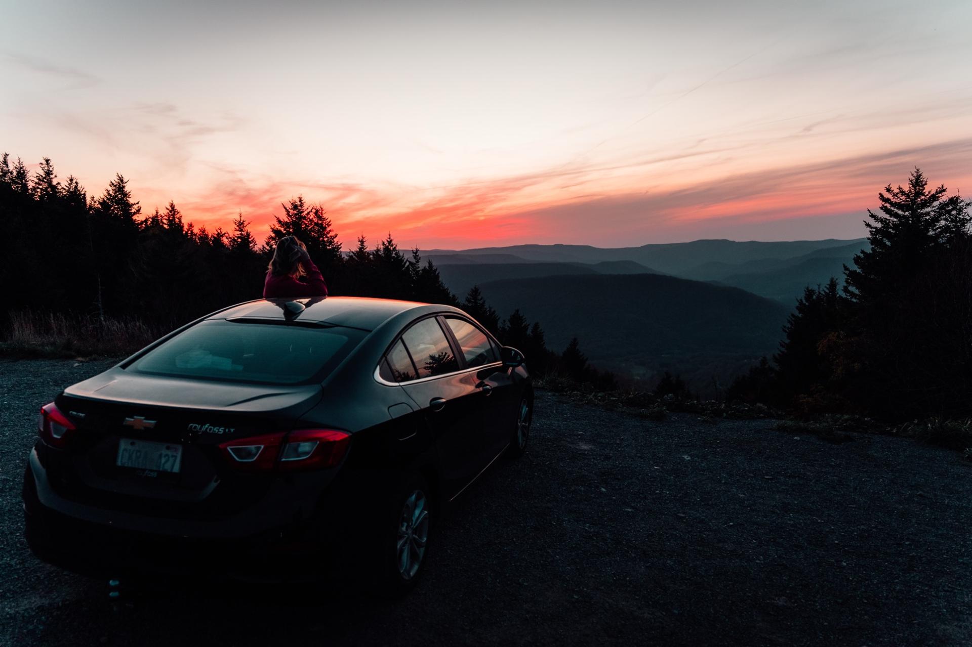
Sunset at a mountain overlook on the drive up to Snowshoe

Getting here

Getting to Snowshoe

the drive is part of the trip

Snowshoe is about 3 hours from Charlottesville, 4 to 4.5 from Pittsburgh, DC, and Richmond, and about 6 from Virginia Beach, and the last hour is two-lane road through the national forest with no interstate in sight. That is the point. Here is how long it takes from where you live, which airport to use, the last hour mile by mile with where the gas and the signal run out, and exactly where to park at each of our homes.

By car

How long is the drive?

Pick where you are coming from and the month. We give you the honest time, the way we go, and a leave-by time that keeps the last climb in daylight. Normal conditions, no stops.

Prefer a map? The resort's directions page has turn-by-turn from each direction.

Washington, DC to the Village

4 to 4.5 hours

I-66 to I-81, Corridor H to Moorefield, WV-55 and WV-28 through Petersburg, Seneca Rocks, and Green Bank, then WV-66 up through Cass

To be on the mountain road in daylight, leave by about 3:00pm. Sunset at Snowshoe in September is roughly 7:30pm.

Last full grocery is Elkins from the north or Marlinton from the south, and last gas is Par Mar at the Route 66 turn in Slatyfork. Coming up from Cass, shop in Staunton or Petersburg and fill at Trent's in Arbovale before Green Bank.

All drive times to the Village

FromDriveThe way we go
Charlottesville, VAabout 3 hoursI-64 west to Staunton, US-250 over the mountains, then WV-66 up through Cass
Pittsburgh, PA4 to 4.5 hoursI-79 south to Weston, US-33 to Elkins, US-219 south to Slatyfork, Route 66 up
Washington, DC4 to 4.5 hoursI-66 to I-81, Corridor H to Moorefield, WV-55 and WV-28 through Petersburg, Seneca Rocks, and Green Bank, then WV-66 up through Cass
Baltimore, MD4.5 to 5.5 hoursI-70 to I-81 south, then Corridor H, Petersburg, and Cass, the same ending as DC
Roanoke, VA3 to 3.5 hoursUS-220 north through Clifton Forge, then VA-42/VA-39 and US-219 to Marlinton, the shortest drive on this list
Northern Virginia (Fairfax)3.5 to 4.5 hoursSame as DC without the city: I-66 to I-81, Corridor H, then Seneca Rocks, Green Bank, and Cass
Richmond, VA4 to 4.5 hoursI-64 to Staunton, US-250 over the mountains, WV-66 up through Cass. In snow, I-64 to Lewisburg and US-219 north through Marlinton
Norfolk and Virginia Beach, VA5.5 to 6.5 hoursI-64 to Staunton, US-250 through Monterey, WV-66 up through Cass. In snow, I-64 to Lewisburg and US-219 north through Marlinton
Charlotte, NC5.5 to 6 hoursI-77 north to Beckley, I-64 east to Lewisburg, then US-219 north through Marlinton
Columbus, OH5 to 6 hoursUS-33 and US-50 to Clarksburg, I-79 to Weston, US-33 to Elkins, US-219 south. Or I-77 to Beckley and I-64 to Lewisburg
Charleston, WV3 to 3.5 hoursI-64 east to Lewisburg, then US-219 north through Marlinton

How far is it?

Not one of those eleven cities?

Enter any address for the real driving distance and drive time, either to Snowshoe in general or to one specific home's own pin.

Your address

By air

The nearest airports

There is no airport shuttle to the mountain. Rent a car, and ask for all-wheel drive between December and March. Drive times are from the terminal to the Village.

  • ROA

    Roanoke-Blacksburg Regional

    Roanoke, VA

    about 3 hours to the Village

    Shortest drive of the four majors, and the prettiest, up US-220 through the Alleghenies.

  • CRW

    Yeager

    Charleston, WV

    about 3 hours 15 minutes to the Village

    In-state and easy. I-64 east to Lewisburg and US-219 north through Marlinton. In summer, I-79 to US-19 and WV-39 east through Richwood is the scenic way; the Highland Scenic Highway (WV-150) is not maintained in winter.

  • IAD

    Washington Dulles

    Dulles, VA

    about 4 hours to the Village

    The most flights and the best fares. Rent a car with AWD in winter.

  • PIT

    Pittsburgh International

    Pittsburgh, PA

    about 4 hours to the Village

    A good option for the Midwest. I-79 south, then two-lane roads through Elkins.

  • LWB

    Greenbrier Valley

    Lewisburg, WV

    about 1 hour 30 minutes to the Village

    The closest airport, with limited regional service. Worth checking if you are connecting through Chicago or DC.

Times are approximate and assume normal traffic and dry roads.

The last hour

Up the mountain

where the GPS gets creative

From the north, south, and west you end up on US-219 to Slatyfork, turn onto Route 66 at Par Mar, and climb the main entrance. From the east, and on our own drive from Virginia Beach, you come up the back of the mountain from Cass on WV-66 instead; it is steeper, and in snow we go around by Marlinton. Here is what to know about that last stretch.

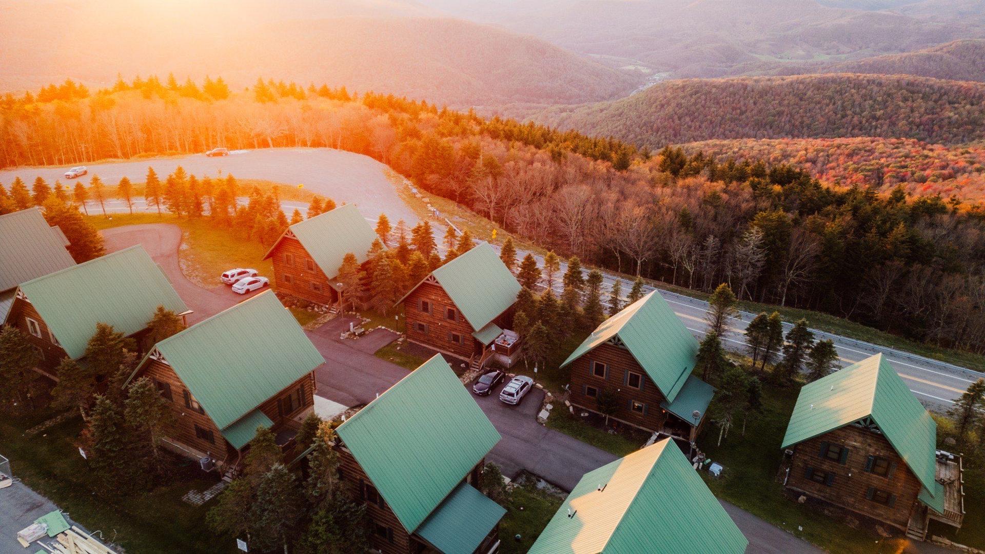
Snowshoe homes at sunset from the air
  • Navigate to the resort, then to our pin

    Put Snowshoe Mountain Resort in your GPS for the long part of the drive. Once you pass the Route 66 turn in Slatyfork, switch to the exact Google pin we send you. Street addresses on the mountain resolve to the resort entrance, not the door.

  • Last gas and groceries

    Par Mar at the corner of US-219 and Route 66 in Slatyfork is the last fuel before the climb. The last full grocery stores are in Elkins (from the north) and Marlinton (from the south). Coming up the back of the mountain from Cass, Trent's General Store in Arbovale, just before Green Bank, is the last gas and the last real store, and it closes at 7pm and on Sundays. Nothing is open on the mountain road.

  • The climb is about 15 minutes

    From the base at Route 66 to the Village is a steady, winding climb with a few switchbacks. It is paved and plowed the whole way. Drive it in daylight the first time if you can.

  • Cell service fades

    You will lose signal on parts of US-219 and most of the climb. Download offline maps and our check-in message before you leave home.

  • Expect deer

    Dusk and dawn on US-219 and Route 66. Slow down and use your high beams when the road is empty.

  • Check the road before a winter trip

    WV 511 has live plow and closure status. The resort road is treated, and in six seasons of hosting we have never had a guest need chains. AWD and good tires are the real answer.

  • WV 511 road conditions ↗Summit forecastOur pins on the map

Cell service and gas

The last hour, stop by stop

Where the signal goes, where the last gas is, and what to do at each point. Read it once before you leave and you will not need it on the road.

  1. 1

    Elkins (from the north, about an hour out) or Marlinton (from the south, 30 to 40 minutes out). From the east, Staunton is the big stop and Trent's in Arbovale, 20 minutes before Cass, is the last one

    SignalNormal

    Fuel and foodLast full grocery, pharmacy, bank, and a real choice of gas

    This is the big stop. Groceries for the first night at least, cash if you want it, and a full tank. Everything after this is smaller.

  2. 2

    US-219 through the valley

    SignalPatchy, gone in the dips

    Fuel and foodA few small stations, hours vary

    Two-lane road with deer at dusk and dawn. Slow down, use the high beams when it is empty, and do not count on a bar of signal for the map. Your offline map is doing the work now.

  3. 3

    Slatyfork, the Par Mar at the Route 66 turn, about 25 minutes below the Village

    SignalUsually one or two bars, the last reliable spot

    Fuel and foodLast gas before the climb

    Fill up if you did not in town, send the "almost there" text, and switch the GPS from Snowshoe Mountain Resort to our exact pin. The turn onto Route 66 is right at the station.

  4. 4

    Route 66, the climb, about 15 minutes

    SignalLittle to none for stretches

    Fuel and foodNothing

    Steady, winding, paved, and plowed the whole way, with a few switchbacks. Drive it in daylight the first time. AWD or good tires in winter; in six seasons no guest has needed chains.

  5. 5

    The top: the resort gate, then our pin

    SignalBack to normal on most carriers, and WiFi at every home

    Fuel and foodWildcat Grocery near the main road for basics and beer

    Drive through the gate to our pin, not to the Village. The door code in your check-in message works whenever you arrive. If the lot looks wrong or you are circling, text us and describe what you see.

Columns: where you are, what the signal does, what is open, what we would do. The big grocery stop, by route, is on groceries and gas. Once you are here, the maps page has the pin for each home and the dining guide has the first dinner.


Arrival tips

What changes by season

Winter

Thanksgiving to late March

  • Leave early enough to reach Slatyfork before dark.
  • AWD or 4WD recommended. Pack a scraper and a blanket.
  • Holiday weekends and Presidents' Day bring the busiest check-in lines at the resort gate. You skip those, your code is already on your phone.
  • Wear boots for the walk from the car. Paths ice over at night.

Spring closure

Early April to late May

  • The resort gate may be unstaffed. Drive straight through to our pin.
  • Some roads get spring gravel work. Give yourself an extra ten minutes.
  • Bring groceries for the stay. Village hours are short.

Summer

Late May to mid-October

  • Festival weekends (4848, Ballhooter, GNCC) mean slow traffic on the climb. Arrive before 3pm or after 7pm.
  • Bikes stay outside or in the mud room, never inside the home.
  • 1208 Silver Creek has an EV charger. If you are in another home, top up in Elkins or Marlinton.

Fall closure

Mid-October to Thanksgiving

  • Peak color traffic on the Highland Scenic Highway on October weekends. The resort road itself is quiet.
  • Frost most mornings. Pack for both seasons.
  • Fewer restaurants open, so plan the first dinner before you climb.

Parking

Where to park at each home

Your check-in message repeats this with the specifics for your stay. Trailers and oversized vehicles need a heads-up from us first, and the resort has its own rules for those.

EV drivers: 1208 Silver Creek has a charger at the home. For the others, charge before the climb.

  • Two cars per building, first come, first served, in the lot right outside. We leave two hang-tag passes in the condo, one per car. Overflow parking is a paid lot near the Village (about $20 a day when we last checked) or free at the Top of the World lot on the Soaring Eagle side.

  • Two dedicated spaces labeled #3, one on each side of the driveway. The Timbers roads are plowed with the rest of the resort.

  • A 1.5-car garage (one car, or a car and a motorcycle) plus three more spaces in the driveway, four vehicles total. The Timbers roads are plowed with the rest of the resort.

  • Underground heated garage in Soaring Eagle Lodge. Pick up your key card first (where to collect it is in your check-in message); it opens the garage door and the elevator takes you straight up. No scraping ice off the windshield.

  • Silver Creek Lodge's guarded lot. Silver Creek issues the passes, so after you book Sarah asks for your email and registers your stay on their website. Print the confirmation, hand it to the attendant at the front of the lot, and they give you your passes. Two public Level 2 EV chargers sit in the Red Spruce A lot; not ours, first come first served.

Questions

Getting-here FAQ

Anything else, . We answer within the hour, and we would rather you ask than guess on a mountain road.

Do I need a four-wheel-drive car to get to Snowshoe?

In winter we recommend AWD or 4WD with real tread, but it is not required. The resort plows and treats the road up, and front-wheel-drive cars with good tires make it up most days.

Rear-wheel-drive sports cars are the ones that get stuck. Chains are not required in West Virginia and none of our guests has ever needed them.

Can I get to Snowshoe without a car?

Not easily. There is no train or scheduled bus to the mountain, and the airports are 90 minutes to 4 hours away, so rent a car at the airport.

Once you are here, the Summit condos are a five-minute walk to the Village and the resort runs a free shuttle around the mountain in season.

Which airport is closest to Snowshoe, WV?

Greenbrier Valley (LWB) in Lewisburg is about 90 minutes but has limited flights. Roanoke (ROA) and Charleston (CRW) are about 3 hours.

Dulles (IAD) and Pittsburgh (PIT) are about 4 hours and have the most flights and rental cars.

Where is the last gas station and grocery store before Snowshoe?

Par Mar at the junction of US-219 and Route 66 in Slatyfork is the last gas, about 25 minutes below the Village.

The last full grocery stores are in Elkins if you come from the north and Marlinton if you come from the south. Wildcat Grocery in the Village covers basics and beer.

Is there EV charging at Snowshoe?

None of our homes has its own charger. Silver Creek Lodge has two public Level 2 chargers in the Red Spruce A lot, first come first served, a short walk from 1208 Silver Creek.

For everything else, charge in Elkins or Marlinton on the way in, and check PlugShare before you rely on one.

Where do I park?

It depends on the home. The Summit condos have two spaces per building with paid overflow near the Village. Timbers 3 has two labeled spaces; Timbers 5 has a 1.5-car garage plus three more in the driveway.

305 Soaring Eagle has a heated underground garage. 1208 Silver Creek uses the lodge lot with a parking pass. Full details are on this page.

Keep exploring

More of the Snowshoe guide

Where to stay

Park once and walk

Every one of our homes is on the mountain, not at the base. Park when you arrive and leave the car until you go home.

See all seven homes